Navigation Apps 2026: Best for US Road Trips?
Welcome, fellow adventurers and road warriors! As we cruise into 2026, the digital landscape of travel continues to evolve at a blistering pace. For anyone planning a grand US road trip, the question isn’t just ‘where to go?’ but ‘how will I get there?’ In an era dominated by smart technology, navigation apps have become indispensable companions. But with so many options vying for our attention, and with constant updates rolling out, are the two leading navigation apps still the undisputed champions for navigating the vast and varied terrain of the United States? This comprehensive guide dives deep into the latest features, performance, and user experience of these prominent navigation solutions, helping you decide which one deserves a prime spot on your dashboard for your next great American adventure.
Unpacking the Latest Features of 2 Leading Navigation Apps: Are They Still the Best for US Road Trips in 2026?
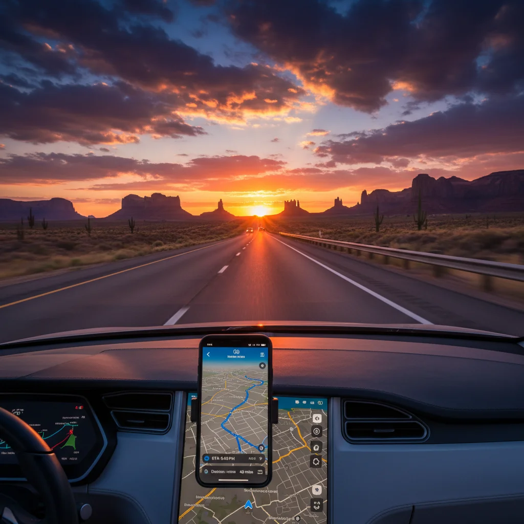
A US road trip is more than just a journey; it’s an experience. From the sun-drenched coasts of California to the historic byways of New England, and the majestic national parks in between, reliable navigation is paramount. Gone are the days of unfolding cumbersome paper maps or relying solely on outdated GPS devices. Today, our smartphones and tablets, powered by sophisticated navigation applications, serve as our digital co-pilots. But as technology advances, so do our expectations. We demand real-time traffic updates, accurate ETAs, offline capabilities, points of interest, and intuitive interfaces. The year 2026 brings with it a fresh wave of enhancements and challenges for these apps. Let’s explore whether the familiar titans of navigation have kept pace, or if new contenders are poised to steal their crown for the ultimate US road trip companion.
The Ever-Evolving Landscape of US Road Trip Navigation
The beauty of a US road trip lies in its spontaneity and diversity. One moment you might be cruising on a multi-lane interstate, the next you’re winding through a remote national forest with spotty cell service. This dynamic environment presents unique challenges for navigation apps. In 2026, the leading apps have had to adapt, integrating more robust offline mapping, advanced AI for predictive traffic, and hyper-localized recommendations. The goal remains the same: to provide a seamless, stress-free, and enjoyable journey, regardless of the destination or prevailing conditions.
Key Considerations for US Road Trip Navigation in 2026
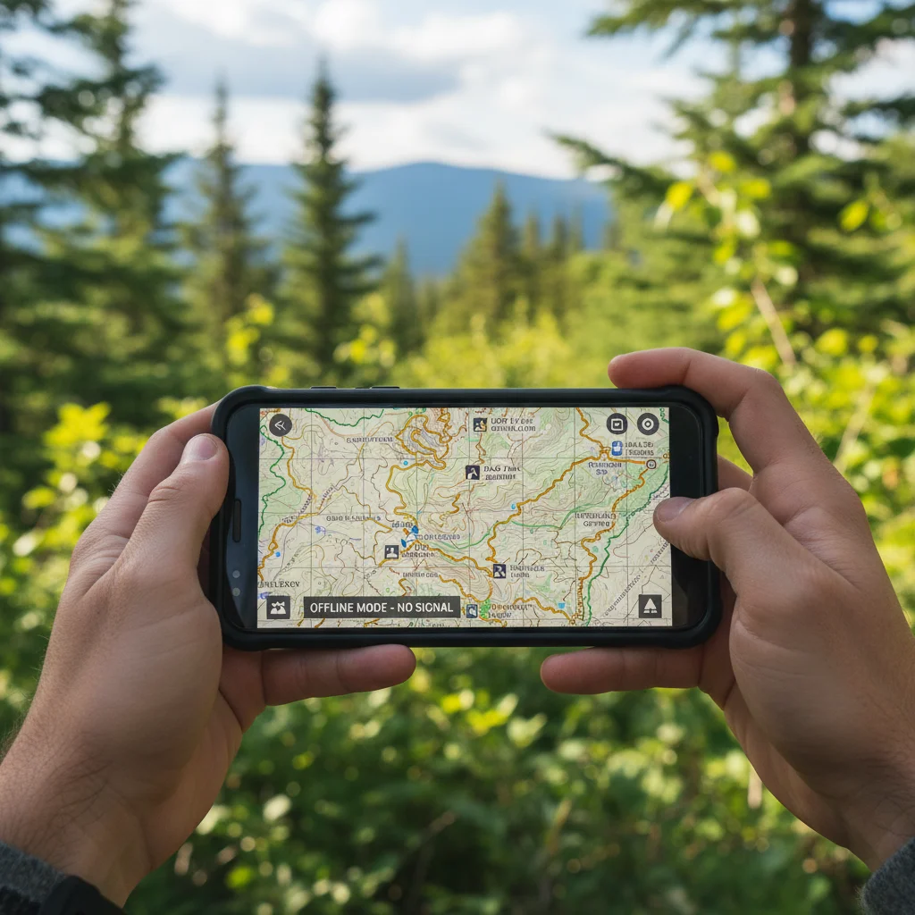
- Offline Capabilities: Crucial for areas with no cell service, which are abundant in national parks and rural routes across the US.
- Real-time Traffic and Incident Reporting: Essential for urban areas and popular routes to avoid delays.
- Points of Interest (POIs): Gas stations, restaurants, rest stops, attractions, and charging stations for EVs are vital for planning.
- Voice Guidance: Clear, concise, and timely instructions to keep eyes on the road.
- User Interface (UI) and Experience (UX): Intuitive design that’s easy to read and interact with, even while driving.
- Customization and Planning Tools: Ability to plan multi-stop itineraries, avoid tolls/highways, and select scenic routes.
- EV Charging Station Integration: Increasingly important for electric vehicle owners.
- Safety Features: Speed limit warnings, lane guidance, and accident alerts.
App 1: The Established Giant – Google Maps in 2026
Google Maps has long been the go-to for many, and for good reason. Its comprehensive database of places, real-time traffic data, and Street View integration make it a formidable tool. In 2026, Google has continued to refine its offering, focusing on deeper integration with its ecosystem and predictive AI.
What’s New and Improved in Google Maps for US Road Trips (2026)?
1. Hyper-Personalized Routing and Recommendations
Google Maps in 2026 leverages your search history, saved places, and even your Google Assistant interactions to offer more personalized route suggestions. For instance, if you frequently search for vegan restaurants, it might highlight such options along your route. This level of personalization aims to make your US road trip not just about getting from A to B, but about discovering things tailored to your preferences.
2. Advanced Predictive Traffic and Incident Avoidance
While Google Maps has always excelled at real-time traffic, the 2026 iteration boasts even more sophisticated predictive algorithms. By analyzing historical traffic patterns, local events, and even weather forecasts, it can anticipate congestion further in advance, offering proactive re-routing options. This is a game-changer for avoiding unexpected delays on long US road trip segments, especially around major metropolitan areas.
3. Enhanced Offline Maps with Intelligent Download Suggestions
Recognizing the Achilles’ heel of online-only navigation, Google Maps has significantly beefed up its offline map capabilities. Not only are downloads more efficient, but the app now intelligently suggests areas to download based on your planned itinerary, ensuring you’re covered even in the most remote parts of your US road trip. These offline maps now include more detailed POIs and even some voice guidance functionality, albeit with limitations compared to online use.
4. Integrated EV Charging Network and Range Prediction
For the growing number of EV owners, Google Maps in 2026 is an absolute necessity. It provides real-time availability of charging stations, filters by connector type and charging speed, and even integrates with your vehicle’s battery level (if connected via Android Auto or Apple CarPlay) to predict range and suggest optimal charging stops. This feature alone mitigates significant range anxiety for EV US road trip enthusiasts.
5. Immersive View for Route Previews
A visually stunning addition, Immersive View allows you to preview your entire route in a rich, 3D environment, offering a ‘fly-through’ experience. While perhaps less critical for active navigation, it’s an incredible tool for pre-trip planning, letting you virtually experience complex intersections or scenic stretches of your US road trip before you even hit the road.
Pros of Google Maps for US Road Trips in 2026
- Unparalleled database of POIs and businesses.
- Superior real-time and predictive traffic information.
- Excellent integration with other Google services (Gmail, Calendar, etc.).
- Robust EV charging station finder and range prediction.
- User-friendly interface with clear voice guidance.
Cons of Google Maps for US Road Trips in 2026
- Offline maps, while improved, still require foresight to download and can be less feature-rich than online.
- Can be a battery drain if used extensively without charging.
- Some users report a preference for specific routing algorithms in competitor apps for pure efficiency.
App 2: The Community-Driven Innovator – Waze in 2026
Waze, acquired by Google, has always stood out due to its community-driven approach to real-time traffic and incident reporting. Its strength lies in its active user base, who constantly report road conditions, hazards, and police presence. In 2026, Waze continues to lean into this community aspect while integrating more advanced features.
What’s New and Improved in Waze for US Road Trips (2026)?
1. Enhanced Community Reporting with AI Verification
Waze’s core strength remains its community. In 2026, the app has introduced an AI layer to verify user reports more quickly and accurately. This minimizes false alarms and ensures that the real-time data you receive about speed traps, accidents, or road closures is highly reliable. For a US road trip, where unexpected events can throw off your schedule, this immediate, verified information is invaluable.
2. Predictive Routing Based on User Behavior and Events
Beyond standard traffic, Waze now uses its vast data from millions of users to predict how local events (concerts, sports games, festivals) might impact traffic flows, even before official reports. This allows Waze to offer smarter, pre-emptive re-routing, helping you avoid major bottlenecks before they even form. This is particularly useful when navigating unfamiliar cities during your US road trip.
3. Advanced Lane Guidance and Complex Interchange Navigation
Navigating complex highway interchanges in unfamiliar cities can be stressful. Waze in 2026 offers significantly improved lane guidance, with clearer visual cues and timely voice prompts that help you get into the correct lane well in advance. This reduces anxiety and improves safety, especially when driving through major metropolitan areas during your US road trip.
4. Integrated Parking Assistance with Real-time Availability
Finding parking, especially in popular tourist destinations or city centers, can be a major headache. Waze has expanded its parking assistance feature to include real-time availability data for parking garages and lots, and in some cities, even street parking predictions. This feature can save considerable time and frustration, enhancing the overall US road trip experience.
5. Personalized Audio Experience with Spotify/Apple Music Integration
While not directly a navigation feature, Waze in 2026 offers seamless integration with popular music streaming services like Spotify and Apple Music directly within the app. You can control your playlist without switching apps, keeping your focus on the road and your US road trip soundtrack flowing. This small but significant UX improvement adds to the enjoyment of long drives.
Pros of Waze for US Road Trips in 2026
- Exceptional real-time traffic and incident reporting from its community.
- Proactive re-routing to avoid unexpected delays.
- Excellent for navigating urban environments and avoiding speed traps.
- User-friendly interface with fun, customizable voice options.
- Integrated parking assistance for city destinations.
Cons of Waze for US Road Trips in 2026
- Relies heavily on an active data connection; offline capabilities are limited compared to Google Maps.
- Can sometimes suggest less intuitive routes based on traffic avoidance, leading to longer distances.
- Less comprehensive POI database for very remote areas compared to Google Maps.
- Battery consumption can be high due to constant data exchange.
Side-by-Side Comparison: Which Reigns Supreme for US Road Trips in 2026?
Choosing between these two powerhouses for your US road trip in 2026 often comes down to your priorities and the nature of your journey. Let’s break down how they stack up in key areas:
1. Offline Navigation
Google Maps: Clear winner. Its significantly improved offline map downloads and functionality make it the safer bet for venturing into areas with no cell service, which are common across US national parks and rural states. This is a critical factor for any extensive US road trip planner.
Waze: Limited. While it offers some basic offline caching, it’s not designed for true offline navigation over long distances. If you anticipate losing signal, Waze will struggle.
2. Real-time Traffic and Incident Reporting
Waze: Edge. The community-driven, AI-verified reporting in Waze often provides more immediate and granular details about specific hazards (potholes, stalled vehicles, police presence) than Google Maps. For avoiding unexpected delays in high-traffic corridors, Waze often shines. This is crucial for maintaining your US road trip schedule.
Google Maps: Excellent, but slightly less granular. Its predictive traffic is arguably more sophisticated for overall congestion, but specific incident reporting might lag behind Waze’s community.
3. Points of Interest (POIs) and Discovery
Google Maps: Unrivaled. Its vast database, integrated reviews, photos, and business information make it the superior choice for discovering gas stations, restaurants, attractions, and accommodations along your US road trip route. The personalized recommendations further enhance this.
Waze: Good, but focused more on utilitarian stops. It excels at finding gas stations and parking, but its discovery features for restaurants or specific attractions are not as rich or comprehensive as Google Maps.
4. EV Charging Integration
Google Maps: Superior. Its deep integration with charging networks, real-time availability, and vehicle range prediction makes it the definitive choice for EV owners planning a US road trip.
Waze: Improving, but not as robust. While Waze does show charging stations, its level of detail and integration with vehicle data isn’t as advanced as Google Maps.
5. User Interface (UI) and Ease of Use
Both apps offer intuitive interfaces, but with different philosophies. Google Maps opts for a cleaner, more traditional map view. Waze’s interface is more playful and icon-driven, with more on-screen alerts. Personal preference plays a big role here, but both are generally easy to use while driving for your US road trip.
6. Route Customization and Planning
Google Maps: Strong. Offers robust multi-stop planning, options to avoid tolls/highways, and detailed route previews. Its desktop planning tools are also excellent for pre-trip organization.
Waze: Good for dynamic re-routing, but less focused on extensive pre-planning. While it can handle multiple stops, its strength lies in real-time adjustments rather than complex itinerary building.
Are There Any Other Contenders for US Road Trip Navigation in 2026?
While Google Maps and Waze dominate, it’s worth briefly mentioning a few other apps that might appeal to specific US road trip needs:
- Apple Maps (for iOS users): Has made significant strides in recent years, offering beautiful 3D maps, enhanced privacy features, and reliable turn-by-turn navigation. Its Look Around feature is impressive, and its integration with Apple CarPlay is seamless. Still, its POI database and offline capabilities aren’t quite on par with Google Maps for extensive US road trips.
- HERE WeGo: An excellent option for true offline navigation, allowing you to download entire states or even countries. Its public transport options are also strong, though less relevant for a pure road trip. It lacks the real-time traffic prowess of Waze or Google Maps.
- Roadtrippers: Not a navigation app in the traditional sense, but an incredible planning tool for US road trips. It helps you discover unique POIs, plan multi-day itineraries, and estimate costs. It integrates with navigation apps for actual driving directions.
- Gaia GPS / AllTrails: For the adventurous US road tripper who plans to combine driving with extensive hiking or off-roading, these apps offer incredibly detailed topographic maps, trail information, and advanced GPS features, often with robust offline support.
The Verdict: Which is the Best for Your US Road Trip in 2026?
After a thorough examination of their 2026 features, it’s clear that both Google Maps and Waze remain incredibly powerful tools for US road trip navigation, each with its unique strengths. There isn’t a single ‘best’ answer, but rather a recommendation based on your specific needs:
Choose Google Maps if:
- You prioritize comprehensive POI discovery, reviews, and business information.
- You need robust and reliable offline mapping capabilities for remote areas.
- You own an EV and require advanced charging station integration and range prediction.
- You prefer a cleaner, more traditional map interface with excellent predictive traffic.
- You value deep integration with your broader Google ecosystem for personalized recommendations.
- You are planning a complex itinerary with many stops and need strong pre-planning tools.
Choose Waze if:
- Your primary concern is avoiding real-time traffic, accidents, and police presence with community-sourced data.
- You frequently drive in urban or highly congested areas where minute-by-minute updates are critical.
- You appreciate a more social, community-driven navigation experience.
- You want advanced lane guidance and parking assistance for city driving.
- You’re less concerned about offline capabilities and more focused on dynamic, real-time routing.
A Hybrid Approach: The Ultimate US Road Trip Strategy for 2026
For the ultimate US road trip experience in 2026, many seasoned travelers advocate for a hybrid approach: utilizing both apps. Here’s how you can leverage their respective strengths:
- Pre-Trip Planning with Google Maps: Use Google Maps on your desktop or tablet to plan your overarching route, identify major POIs, research restaurants and attractions, and download offline maps for key segments of your journey, especially through national parks or rural stretches.
- Real-time Driving with Waze (in populated areas): Once on the road, especially when approaching or driving through cities and high-traffic corridors, switch to Waze for its superior real-time traffic, incident alerts, and police notifications. Its proactive re-routing can save you hours.
- Backup with Google Maps (for remote areas): When you venture into known dead zones for cell service, rely on your pre-downloaded Google Maps. It will guide you reliably until you regain signal.
- EV Charging with Google Maps: If you’re driving an EV, always use Google Maps for planning and locating charging stations, as its integration and data are currently unmatched.
- Discovery and Exploration with Google Maps: For spontaneous stops or discovering local gems, Google Maps’ extensive database and review system will be your best friend.
The Future of US Road Trip Navigation
Looking beyond 2026, the future of US road trip navigation promises even more integration and intelligence. We can anticipate deeper integration with vehicle systems, augmented reality navigation overlays projected onto windshields, and even more sophisticated AI that learns your driving habits and preferences to anticipate your needs before you even voice them. The rise of autonomous vehicles will also undoubtedly reshape how we interact with navigation, potentially transitioning from active guidance to more supervisory roles.
For now, in 2026, the leading navigation apps have demonstrated their commitment to innovation, making them more powerful and indispensable than ever for exploring the vast and beautiful United States. Whether you’re a loyal user of one or prefer to juggle both, understanding their latest features will ensure your next US road trip is smooth, safe, and unforgettable.
Final Thoughts on Your US Road Trip Navigation Strategy
Embarking on a US road trip is an adventure of a lifetime, a journey through diverse landscapes, cultures, and experiences. The right navigation app doesn’t just tell you where to turn; it enhances your entire travel experience by reducing stress, saving time, and helping you discover hidden gems. Both Google Maps and Waze have proven their mettle, constantly evolving to meet the demands of modern travelers.
By understanding their strengths and weaknesses in 2026, you can make an informed decision or, even better, combine their powers for an unparalleled navigational advantage. So, charge your devices, download your maps, and get ready to hit the open road with confidence. The great American adventure awaits, and with the right digital co-pilot, every mile will be a memory in the making.


